A Sixth Grade Field Guide to the Roaring Fork Valley, Colorado
  • Home
  • Maps
  • Alpine Ecosystem
  • Sub-alpine Ecosystem
  • Montane-Mixed Conifer Ecosystem
  • Montane-Aspen Forest Ecosystem
  • Montane--Oak Shrubland Ecosystem
  • Pinyon-Juniper Ecosystem
  • Riparian Ecosystems
  • Natural Cycles
  • Hazards--Drought, Insects, Invasive Plants
  • Hazards--Avalanches, Fire, Floods
  • Glossary

Map Of the roaring fork valley

By: Nic Pevny, Cooper Kendrick, Johannah Cantave

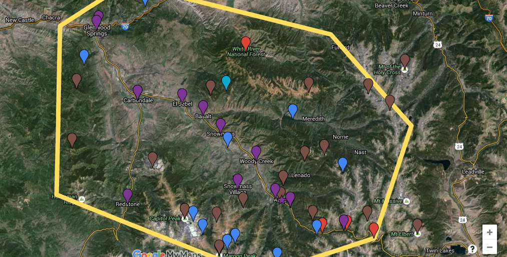
Click on the picture below to go to the google maps. There, you will find the Roaring Fork Valley's  important and famous mountains, lakes/reservoirs, towns/attractions, and ecosystems. Each of these different topics are color coordinated. The brown points are representing different mountains. The blue points represent the bodies of water in the Roaring Fork Valley. The purple points represent the towns and attractions. The red points represent the Roaring Fork ecosystems. If you click on the balloons in the map below a pop up will emerge. In the pop up you will see a picture and in most of them information on the place you chose to click on.
Picture
​Click here for map
Powered by Create your own unique website with customizable templates.
  • Home
  • Maps
  • Alpine Ecosystem
  • Sub-alpine Ecosystem
  • Montane-Mixed Conifer Ecosystem
  • Montane-Aspen Forest Ecosystem
  • Montane--Oak Shrubland Ecosystem
  • Pinyon-Juniper Ecosystem
  • Riparian Ecosystems
  • Natural Cycles
  • Hazards--Drought, Insects, Invasive Plants
  • Hazards--Avalanches, Fire, Floods
  • Glossary